


01/07/2006 Gravity Hill Investigation
by David Richards
|
|
Download report as PDF |
In the fall of 2005 it was suggested the IIG investigate a "mystery spot" just to the North of Los Angeles nicknamed "Gravity Hill" by the local residents. This spot was described as a place on a road where vehicles roll uphill. It was felt this would be a fun outing and a way for some of the of the newer members of the IIG to acquire some field experience. Before the expedition to the site our members conducted some research into this phenomenon.
Background
There are a number of places around the
world, variously called "mystery spots", "vortexes", or other such names. A
very well-known example was the "Haunted Shack", attraction at Knott’s Berry
Farm in Buena Park, California. This was said to be a recreation of an
actual site located somewhere else (if you can intentionally build one of
these where you want it, that alone tells us the effect must not be related
to something special about the geographic location). Incidentally the
attraction was removed from Knott’s in about 2000 to make room for a new
roller coaster. A DVD is available that includes a walk-through of the
Knott’s Haunted Shack, prior to its being removed:
http://01508f4.netsolstores.com/index.asp?PageAction=VIEWPROD&ProdID=129
However there are others of these types of
places are still in existence, such as the Santa Cruz mystery spot and the
Oregon Vortex.
http://www.roadsideamerica.com/attract/CACRUspot.html
http://www.oregonvortex.com/
IIG Investigation
On January 7, 2006, multiple carloads of IIG investigators arrived at the "Gravity Hill" site. As each vehicle arrived, they were directed to the exact spot to experience the effect (see Figure 1).
 |
| Figure 1: Driver's view upon "cresting the hill" |
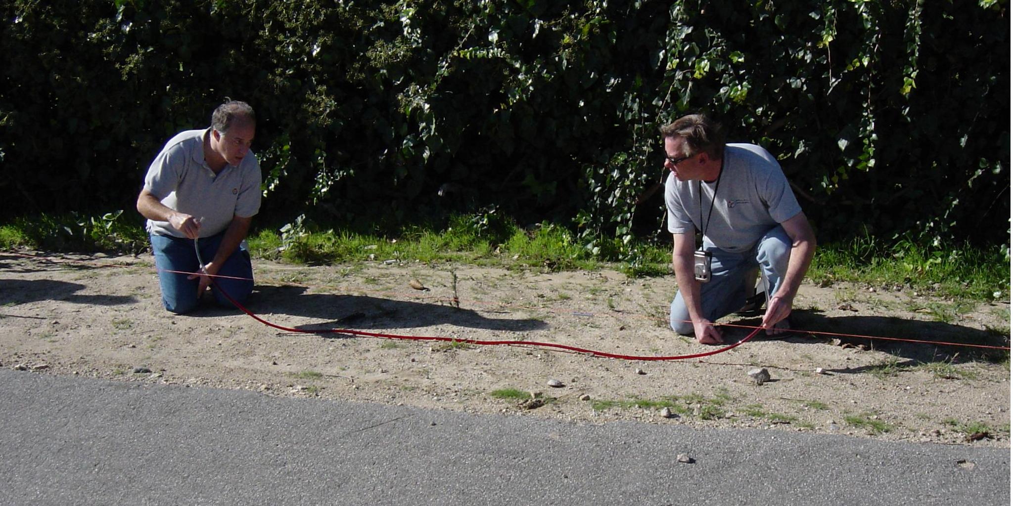
The team proceeded to establish a level reference to measure the ground slope. Several methods of establishing level were used. In the first method, two stakes were driven into the ground alongside the road, and a string stretched between them. A bubble level was attached to the string, and the heights of the string at each end adjusted until the string was level. In another method, colored water was poured into a length of clear plastic tubing to form a water level. The height of the water at each end from the ground was measured.
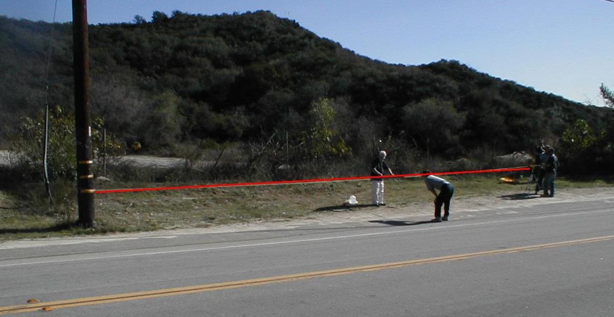
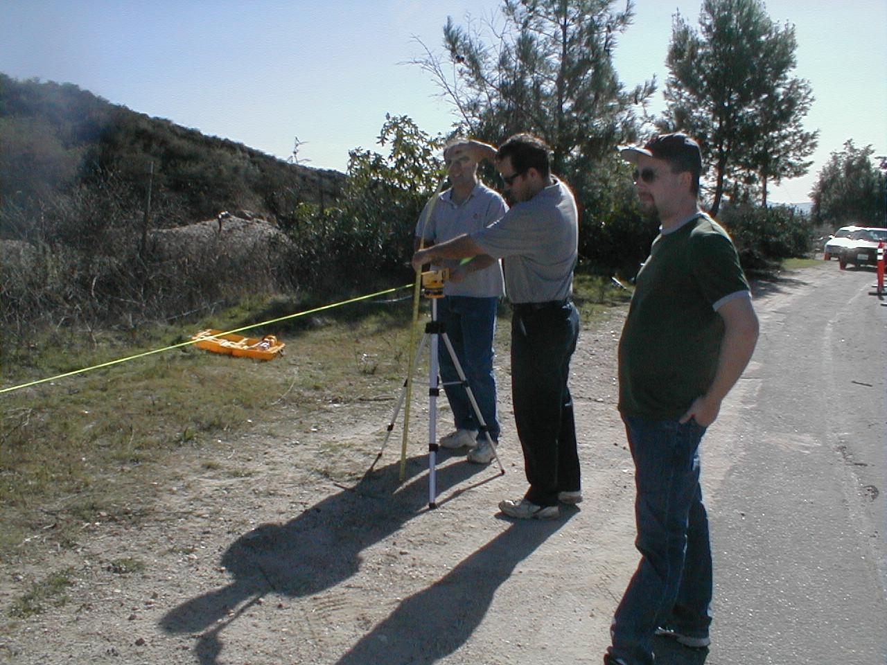
A laser level was used in a third method. It was mounted on a tripod and aimed at a reflector attached to a utility pole to make the beam more visible in daylight. A cord was run from the laser level to the pole to make the line visible in the photos. This is shown in Figures 2 and 3. A bright red line has been superimposed over the cord for even better visibility. In the photos the laser level has been set as close as possible to level.
These three methods all agreed (within measurement error) that the slope was about 2.2 degrees, or a little over 3’ rise per 1000 feet linear run, and in the correct direction to explain the observed vehicle movement. The vehicles were in fact rolling downhill, not uphill as one’s senses suggested.
 |
| Figure 2: Laser level experiment, view A |
But already, in Figure 2 and 3 we appear to have a problem. In Figure 2 the ground appears to be very close to parallel to the level reference line. However in Figure 3, with nothing about the setup changed other than a different viewpoint for the camera, the line is now clearly NOT parallel to the ground! What’s going on here? The answer is simple: perspective. The roadway does in fact have a slope to it. In Figure 2, the camera is located roughly perpendicular to the end of the beam furthest from the laser and its support tripod. So in Figure 2 natural perspective is canceling out the effect of the slope, making the level line appear parallel to the ground. In reality the near end of the beam where it hits the pole is nearer to the ground by about one foot compared to the far end. If the ground was actually level, the red line should appear to dip closer to the ground at the right end (far end) due to perspective. If we continued to extend the line far enough to the right, it should eventually meet the pavement, in the same way railroad tracks appear to meet in the distance. But since the line doesn’t appear to get closer to the road as the distance increases, we can confidently state the ground is actually sloping downward to the right in that photo.
 |
| Figure 3: Laser level experiment, view B |
The opposite is true for the camera location in Figure 3. In Figure 3, the effect of perspective is now adding to the actual ground slope. In other words the ground appears to be sloping more than it actually does.
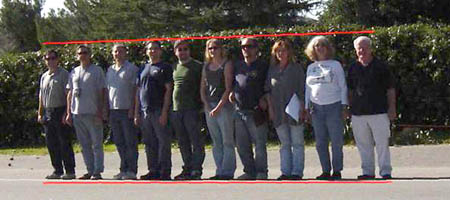
As a final experiment, all the investigators present lined up along the painted line at the side of the road, in order of height. See Figure 4. This is at the same spot on the roadway shown in Figures 2 and 3. You often see these types of photos in publicity materials for these mystery spots. In the Figure 4 photo, the shortest person is on the left, the tallest at the right. Red lines have been added to highlight the height difference.
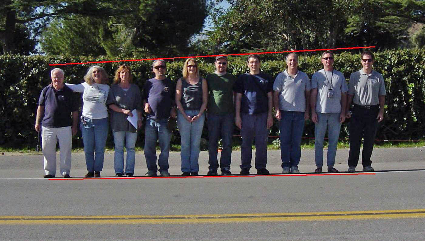 |
| Figure 4: IIG lineup, short to tall |
In Figure 5 the arrangement is reversed. However unlike the publicity photos for mystery spots, no one has changed height – short people are still short, tall people are still tall. The reason nothing changed is the camera is located very near to perpendicular to the center of the line of people. Evidence of this is the yellow line in the street, which is essentially parallel to the bottom of the frame in both photos. Figure 6 is an overhead view showing the placement of the camera in relationship to the line of people.
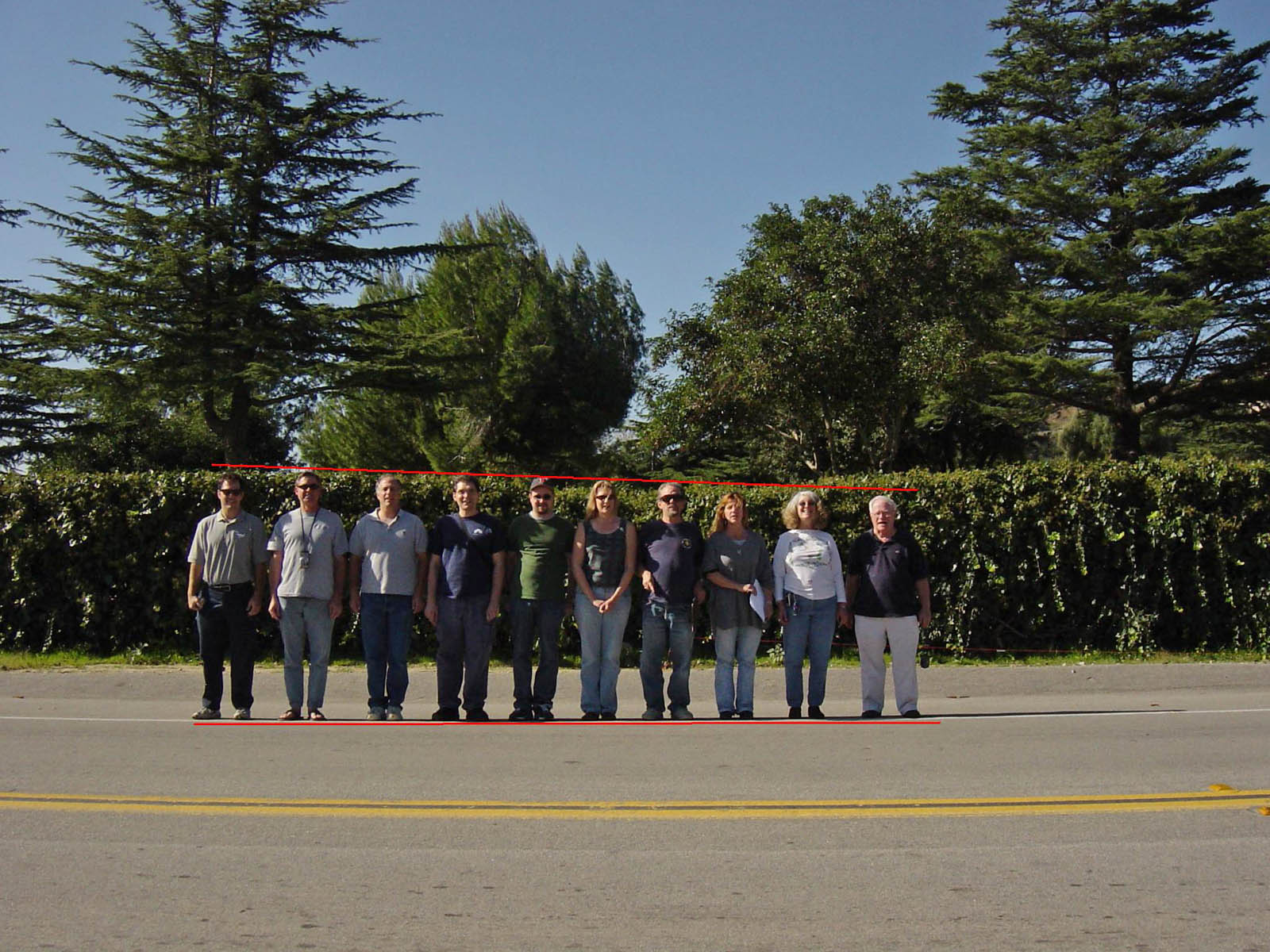 |
| Figure 5: IIG lineup, tall to short |
 |
| Figure 6: Overhead view of Figures 4 & 5 |
By contrast, Figure 7 shows a contrived photo typical of the type used to publicize these "Mystery Spots". The camera has now been shifted to the right, about even with the man at the right end. In this photo everyone now appears to be roughly the same height, even though there is several inches difference in actual height difference from one end to the other. Again, it is simple perspective that’s responsible – the people further away from the camera appear smaller than people closer to the camera. Figure 8 shows the overhead view of the setup.
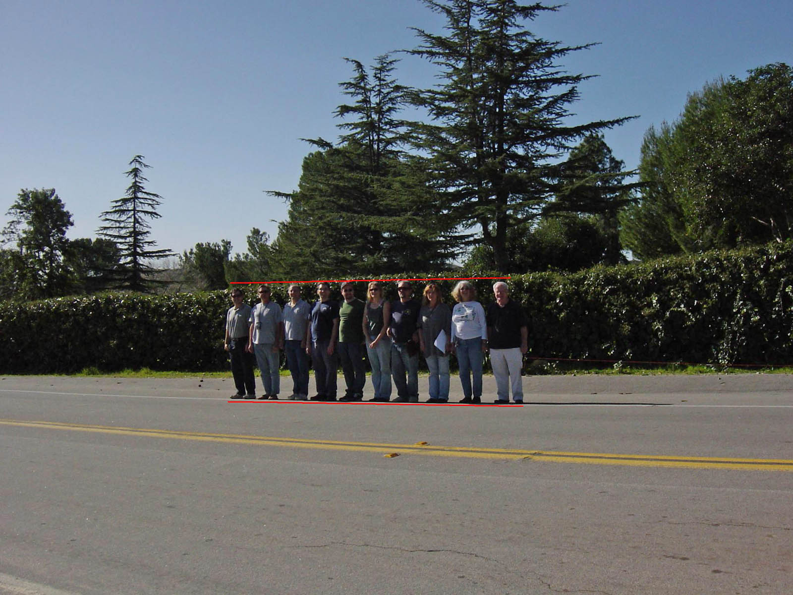 |
| Figure 7: IIG lineup, everyone equal |
 |
| Figure 8: Overhead view of Figure 7 |
So if the Figure 4 photo is compared directly to the Figure 7 photo, it would be somewhat convincing of a strange effect going on, but there are some clues in Figure 7 that indicate it wasn’t taken straight on. The last steps required to make a convincing publicity photo example for a "vortex" are demonstrated in Figure 9.
 |
| Figure 9: Same photo of Figure 7, modified |
The photo in Figure 9 is exactly the same photo in Figure 7, with two modifications made to it:
- The picture has been rotated slightly, so the bottom red line is now parallel to the bottom of the frame. This results in the upper red line now clearly sloping downward to the left, making our tallest members appear to now be shorter than the short members.
- The picture has been zoomed in and cropped to cause the subjects to nearly fill the frame. The yellow lines in the road have been cropped out. This was a cue to the perspective effect. With this cue removed, it’s much more difficult to tell the photo wasn’t taken straight on.
Conclusion
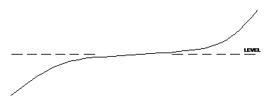
At the particular site examined in this investigation, right before the mystery spot is reached as one travels up the road, it is climbing into the hills at a fairly steep slope. Then the steepness of the road lessens substantially for a short distance, and then it begins a steeper ascent once again. The impression felt by someone traveling up this road is that you have crested a hill, and are going down a slight descent, and then begin climbing another hill. However this is a misleading impression, which was proven by measuring the slope. The direction of the slope never actually reverses throughout this section of road. This is shown graphically in Figure 10.
 |
| Figure 10: Lateral profile of the road at "Gravity Hill" (exaggerated) |
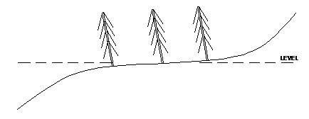
So what is unique about these locations billed as mystery spots or vortices? There are thousands of roads that have the similar type of S-curve profile somewhere along them. And the experiments documented in this report suggest you can create misleading photos pretty much anywhere. Clearly there’s a little something extra required to create a landmark that people perceive this way. This extra something usually has to do with the surroundings giving false visual clues. That is, the shape of the surrounding hills, or perhaps trees growing out of the ground at an angle other than vertical. Figure 11 shows the addition of a stand of trees, all growing at an angle. Such patterns in trees aren’t too unusual, perhaps being affected by prevailing winds. Or instead of trees they could be phone poles or fence posts, all leaning the same direction. Our brains assume such objects are vertical. When they aren’t, and when the direction happens to correspond to some other visual oddity at the spot, it tends to reinforce the impression that the ground is sloping in a different direction than it is in reality.
 |
| Figure 11: Addition of visual cues |
In the case of "Gravity Hill" we don’t find slanted trees or posts, so
it’s not apparent exactly what is responsible for the visual miscuing and
resulting false impression at this site. However all of our investigators
experienced it. There is a hedge that runs alongside the road, which can be
seen in Figures 4, 5, 7, and 9. The hedge isn’t trimmed parallel to the
roadway, which may be partly responsible for the misleading impression.
But in any case our investigation found no violation of physical laws at
this site, the law of gravity seems to be safe for the time being.
Addendum
Below are some additional, miscellaneous photos taken in connection with this investigation.
 |
| Water level being compared to string level, west side of road |
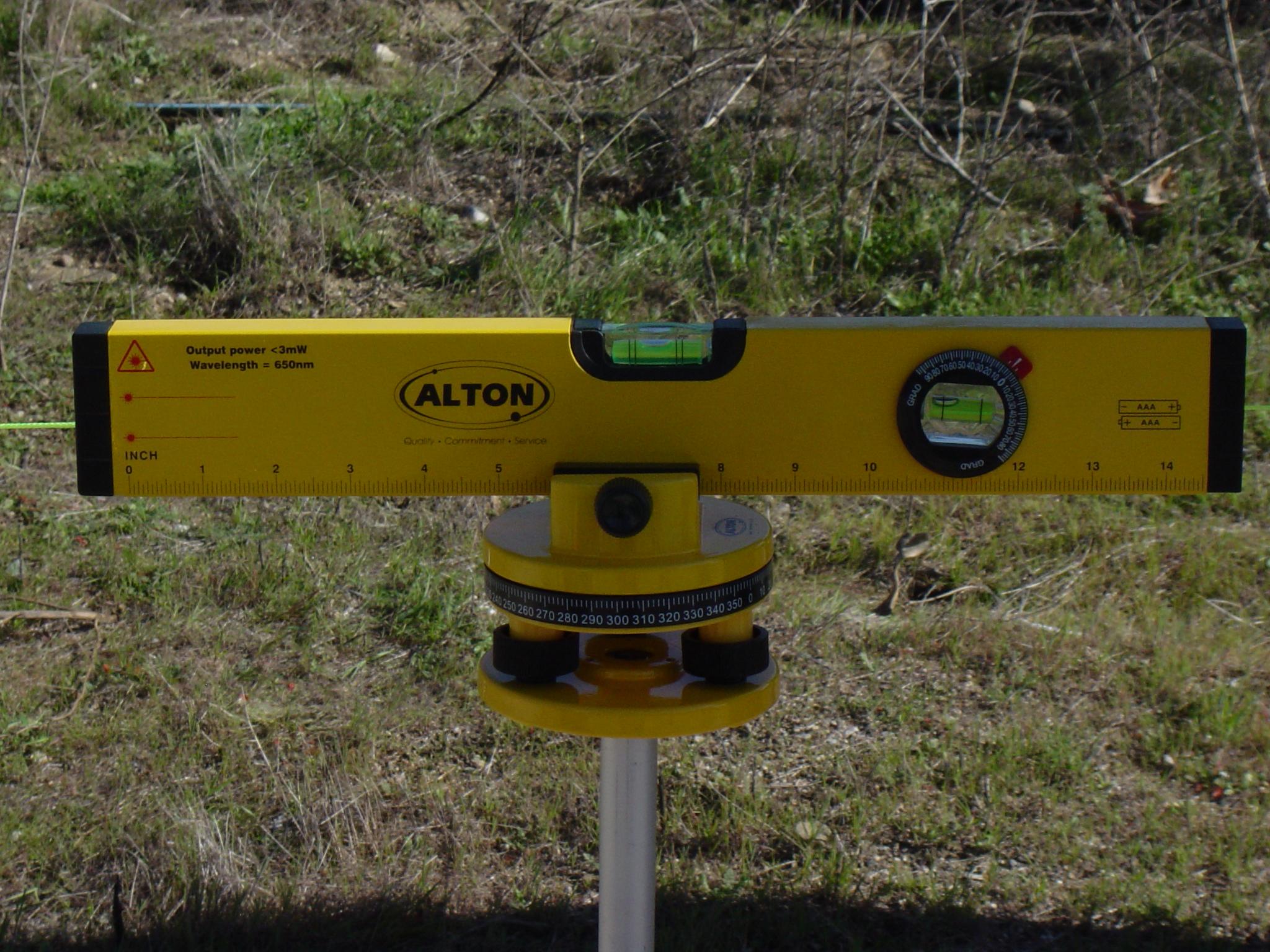 |
| Professional laser level tool |
 |
| Measuring beam height at laser |
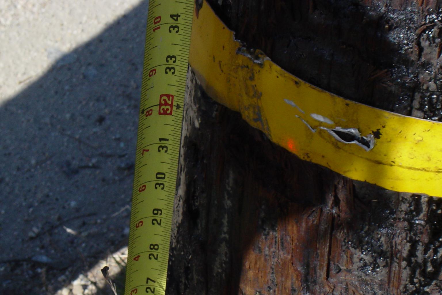 |
| Measuring beam height at target |
Directions
Want to see the uncanny effect of "Gravity Hill" for yourself? There are a number of spots with similar optical effects, but here's how to find the one we investigated. In the town of Sylmar, California:
Exit 210 fwy on Foothill Blvd
Turn R on Foothill (East)
Quick L on Osborne St.
After 2 blocks, L on Garrick Ave.
R on Kagel Canyon, go about 2 miles
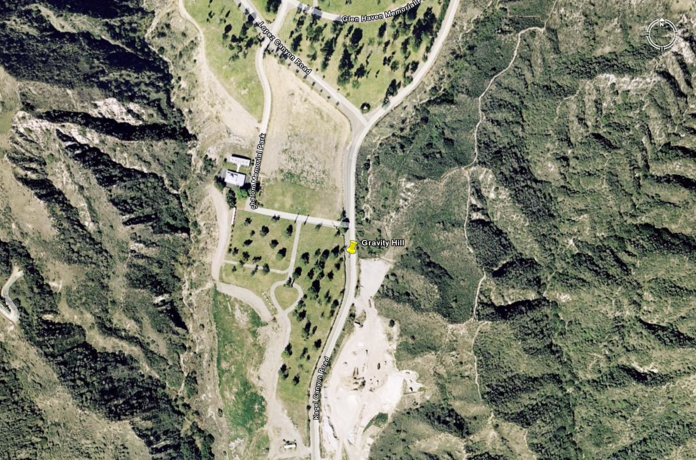
Site is on Kagal Canyon Road, right in front of the entrance to Sholom Memorial Park (N Lat 34.305274, W Long 118.375497).
As you pass hedges on the left and see a couple of large trees and the turn-in to the memorial park on the left, and a utility pole to your right, stop your car, put it in neutral, and take your foot off the brake and you’ll feel it coast backwards, "uphill".
|
|
Download Google Earth .kmz file |